Emergency Drilling and Instrumentation
On February 20, 2013, a landslide occurred on U.S. 89 near Page, Arizona. More than 150 feet of roadway buckled causing an indefinite closure of the highway. The Arizona Department of Transportation (ADOT) paved Navajo Route 20 as an interim solution to the closure as they worked to determine the location and severity of the slide.
Team Members
ADOT
Kleinfelder
Crux Subsurface
Crux’s Role
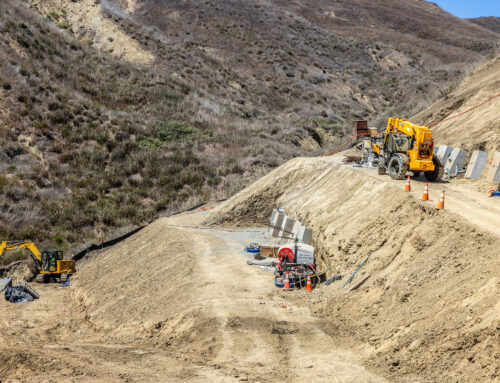
Crux provided emergency core drilling and instrumentation services to the project. The intent of the drilling program was to locate precisely where the landslide occurred, determine if it was still moving, and establish the general stability of the slope. Seventeen core holes were completed, ranging in depth from 29 to 250 feet for a combined total of 1,793 feet. The damage to the roadway created access challenges, requiring a combination of track mounted drill rigs and helicopter support.
Core recovery was successfully completed through challenging subsurface conditions, including the Chinle formation, which is made up primarily of fluvial mudstone, siltstone and sandstone. Optical/acoustical downhole imaging was provided in three borings, and inclinometers were installed in seven borings. In addition to subsurface conditions and access constraints, a major project challenge was successfully drilling and installing inclinometers in an active landslide.
A major project challenge was successfully drilling and installing inclinometers in an active landslide